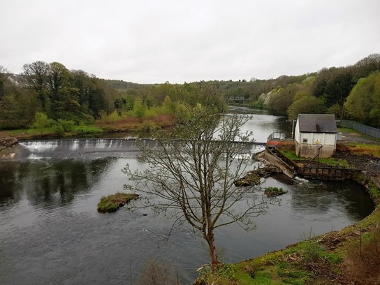
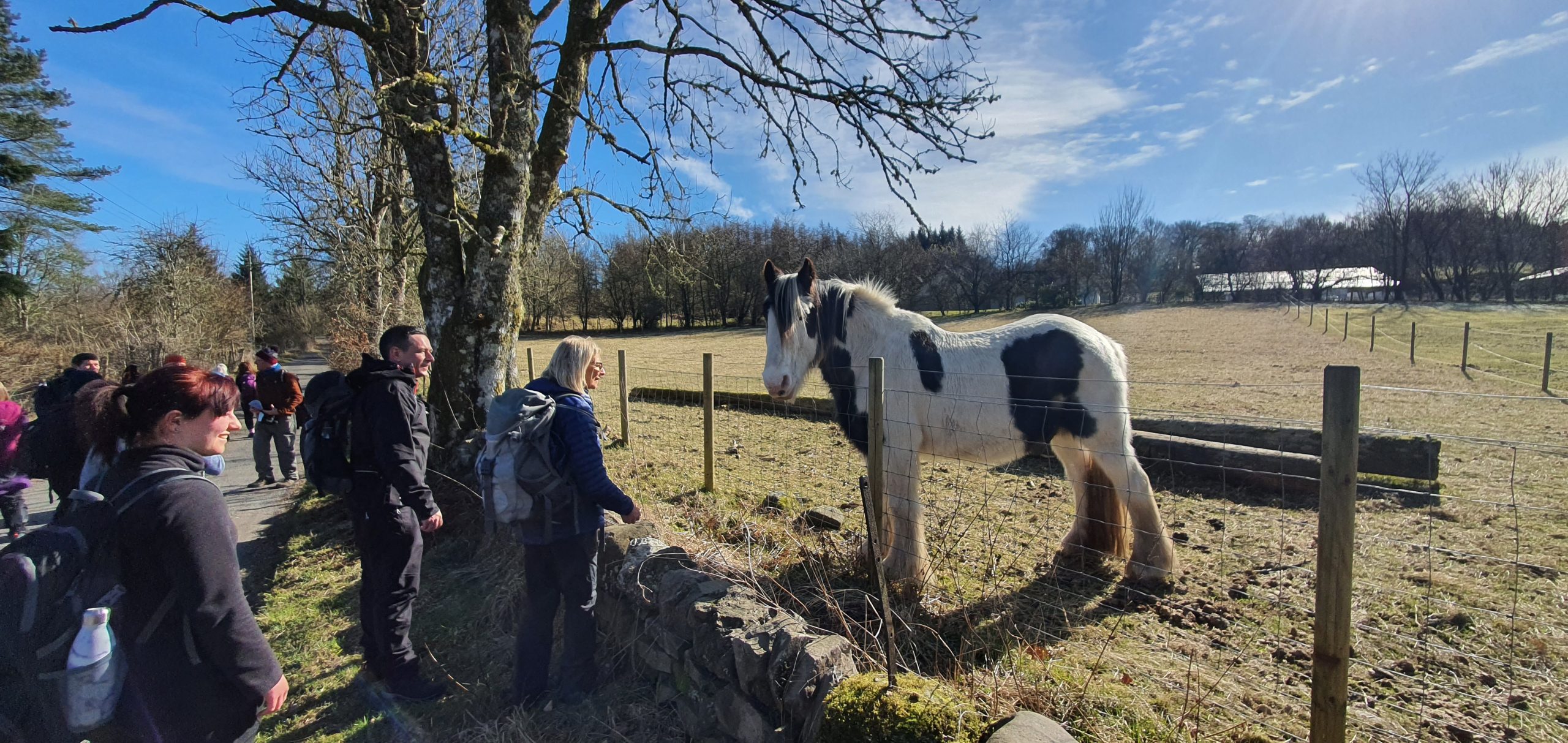
find a walk
weekends & wednesday programme
skip to:
information
For new members...
As we advance from the restrictions made by the pandemic, we the committee would like to update members on the existing decisions made by us to ensure the safety of our members. We have set out a collective of measures which we think will have to stay in place for the time being. We aim to ease our way out of the Covid situation with caution.
There are 4 members of the committee who take names for the walks. The person taking the names will be announced by email to all members on the Wednesday after a walk (sign up to our newsletter at the bottom of the page). If you wish to put your name down for the next walk please read the following:
➝ TEXT ONLY. No emails, phone calls or messages
➝ Give your name, your pick-up point
➝ DO NOT book a seat for more than one person unless a couple or family member
➝ DO NOT text before the list is put out on the Wednesday
➝ DO NOT turn up for a walk on the day
➝ Text only the person who has been named to take the names, which is not always the leader.
Distance Conversion List...
| Km To Miles | Miles To Km |
|---|---|
| 1 Km In Miles = 0.62 Miles | 1 Miles In Km = 1.61 Km |
| 2 Km In Miles = 1.24 Miles | 2 Miles In Km = 3.22 Km |
| 3 Km In Miles = 1.86 Miles | 3 Miles In Km = 4.83 Km |
| 4 Km In Miles = 2.49 Miles | 4 Miles In Km = 6.44 Km |
| 5 Km In Miles = 3.11 Miles | 5 Miles In Km = 8.05 Km |
| 6 Km In Miles = 3.73 Miles | 6 Miles In Km = 9.66 Km |
| 7 Km In Miles = 4.35 Miles | 7 Miles In Km = 11.27 Km |
| 8 Km In Miles = 4.97 Miles | 8 Miles In Km = 12.87 Km |
| 9 Km In Miles = 5.59 Miles | 9 Miles In Km = 14.48 Km |
| 10 Km In Miles = 6.21 Miles | 10 Miles In Km = 16.09 Km |
| 11 Km In Miles = 6.84 Miles | 11 Miles In Km = 17.7 Km |
| 12 Km In Miles = 7.46 Miles | 12 Miles In Km = 19.31 Km |
| 13 Km In Miles = 8.08 Miles | 13 Miles In Km = 20.92 Km |
| 14 Km In Miles = 8.7 Miles | 14 Miles In Km = 22.53 Km |
| 15 Km In Miles = 9.32 Miles | 15 Miles In Km = 24.14 Km |
| 16 Km In Miles = 9.94 Miles | 16 Miles In Km = 25.75 Km |
| 17 Km In Miles = 10.56 Miles | 17 Miles In Km = 27.36 Km |
| 18 Km In Miles = 11.18 Miles | 18 Miles In Km = 28.97 Km |
| 19 Km In Miles = 11.81 Miles | 19 Miles In Km = 30.58 Km |
| 20 Km In Miles = 12.43 Miles | 20 Miles In Km = 32.19 Km |
| 21 Km In Miles = 13.05 Miles | 21 Miles In Km = 33.8 Km |
| 22 Km In Miles = 13.67 Miles | 22 Miles In Km = 35.41 Km |
| 23 Km In Miles = 14.29 Miles | 23 Miles In Km = 37.01 Km |
| 24 Km In Miles = 14.91 Miles | 24 Miles In Km = 38.62 Km |
| 25 Km In Miles = 15.53 Miles | 25 Miles In Km = 40.23 Km |
Transport & Booking...
We run a 49 seater coach to all walks. The current bus fare is £15.00 (late 2022). There can occasionally be additional costs such as ferry fares and local buses. A social event such as a club meal would also involve higher charges. All of the costs will be indicated in the email newsletter.
Bookings are taken on a “First Come – First Served” basis. After the email newsletter is published (usually on a Wednesday) walkers (including first-timers) can make a text booking to the booking contact for that walk (The booking contact will be indicated on the newsletter and may differ from the walk leader). All bookings will receive a text acknowledgement.
There may be number limitations on a walk in which case anyone booking after the limit is reached will be placed on a waiting list. Anyone on the waiting list who does not get a booking will have first refusal on the next walk.
If you are unable to attend a walk please let the booking contact know immediately so that someone on the waiting list can take your place. There is no charge for cancellations.
out on a walk...
When walking with the club, adequate footwear and clothing are essential. Be prepared for adverse weather conditions. Carry a packed lunch. Boots are essential on “A” and “B” grade walks and are recommended on “C” grade walks. The Ramblers Association cannot take responsibility for damages or loss incurred on a ramble or other club activity.
Follow the Country Code:
➝ Close gates;
➝ Take litter home;
➝ Face oncoming traffic, etc
Please do NOT walk in front of the leader or leave a ramble without informing the leader. Children under 16 years of age should be accompanied by an adult. Holidays and social events are offered to club members. All those interested in walking are welcome to join the group. After participating in two walks with the group we would expect you to join the Ramblers Association, otherwise you may not be accepted on a walk.
Membership forms are available from the Group Secretary. Joining the Ramblers Association gives automatic membership of your local group and the right to walk and socialise with any other groups UK-wide. Walks are subject to change at the Leader’s discretion.
Please inform the walk leader of any medical condition(s) which you have incase of any emergency during the walk.
Behind the Scenes...
As a club we pride ourselves in welcoming new members to enjoy the experience of the outdoors and to ensure the safety of all our members. In order to achieve this, we as a committee would like to inform you of how we plan and conduct each walk with your safety in mind.
The Planning of Walks
The planning of a walk begins with the Walks Convener who has to find a suitable walk or walks. This involves (in our club) Stuart Sefton, who generously gives of his own time and effort to research routes that are interesting, scenic and safe. It is not an easy task by any means and consists of weeks or months of research to compile a list for each summer and winter seasons. When Stuart has completed the list it is presented to the committee members for their consideration and any adjustments made. This will include the dates of the walks and who will lead them. We rely on the generosity of our members to volunteer for the walks and to be competent in keeping everyone safe.
The Walk Leader
The responsibility of a walk leader is no easy task. The walk they choose has to be recced in advance. They are given a map by the Walks Convener and they then have to go and familiarise themselves with the route. This is done in their own time. To begin with they have to consider a breakfast stop for members. This involves seeking out cafes that can accommodate our numbers, speaking to the owners to ensure they can meet our needs, and assessing where the bus can park safely. They have to find a safe parking spot for the bus at the start of the walk, and if its a linear walk,- where the bus has to pick us up. The Walk Leader will give a brief talk before the walk to make sure everyone is prepared. They will make sure the paperwork is correct The Leader will appoint a Back Marker who will have accompanied the leader on the recce and also is familiar with the route.
This is to ensure that the group is kept together and no one will be left behind. On the walk itself, the leader will have chosen the best place for short stops and lunch breaks. Timing is essential on a recce. It is important to remind everyone that No one should walk ahead of the leader unless they have given permission to do so. Walk Leaders have a legal responsibility under Ramblers Association rules to ensure everyone is safe and it has been known that people have got lost by going ahead of the leader and taking a wrong turning, this results in a delay trying to locate them and affects the timing of the walk. It is important that no one should go off on their own for ‘comfort stop’ without informing the back marker. If any walker has a medical condition they should inform the Walk Leader in the event of an emergency. It is important that walkers wear the correct clothing and footwear as it is well known that the weather changes quickly. The Walk Leader will take control and be assertive when needed.
All of the above is to ensure that members enjoy the walk, are safe and well informed. In the event that there are 2 walks on the same day, each leader will have done the recce and collaborated on the times on starting the walk and finishing the walk and where the starting point will be and the finishing point. There may be a delay on the finishing time due to location of the walks and any problem that may develop. Please be patient as safety is a priority.
Thank you for your understanding
And the rest...
The Committee welcomes any suggestions for walks which anyone would like to see on either the Summer or Winter programmes, or suggestions for social events.
Please contact any committee member with regard to this and we will endeavour to include these walks or events at the earliest possible opportunity.
Note to Leaders: it would be helpful if leaders of joint walks could do their reccies at the same time as this would assist with determining the timing of the two walks and would also save on reccie expenses.

Height
Metres x 3.3inch = Feet
(150 Metres = 500 Feet Approx.)

Distance
Kilometres x ⅝ mile = Miles
(16 Kilometres = 10 Miles Approx.)
Grade |
Ascent (M) |
Distance (Km) |
Description |
| C | Nil | 9-14 | Easy |
| C+ | 150 | 14-16 | Easy/Moderate |
| B | 150-450 | 16-19 | Moderate |
| B+ | 450-760 | 16-22 | Moderate/Strenuous |
| A | 760-914 | 9-14 | Strenuous |
| A+ | 914+ | 9-19 | Very Strenuous |

Wednesday programme 2026
Updated: 22 June’26
For all updates, please see our “notes” below.
notes:
➜ Walk date, bus & train travel times may change – so check webpage for updates.
➜ The walk Blackridge to Bathgate Linear, which was postponed in December 2025 (replaced by The ‘Angel of the Nauld’) , is now the first walk in this programme.
➜ Our “Binny Craig” walk on 22 July will be replaced with Dumpellier County Park Woodland Circuit, and will be added to our 2027 wednesday programme.
➜ Our club walk on 26 August “The Kelpies & The Carron Nature Reserve has been postponed to 2027, and replaced with St Maurice’s Pond and Broadwood Loch Circular
➜ Our “Green Link Linear” on 16 September has been changed to “Its Graduation Day at Cloisters”.
Book a place on a walk:
WHATSAPP or TEXT the walk leader, Tony Grimason, on 07516238706, No phone calls
➜ ONLY CONTACT the walk leader within 2 weeks of the date of a scheduled walk.
➜ Maximum number on each walk: 16.
➜ Booking is on a first come, first served basis.
➜ A reserve list will be created in the event of cancellations.
➜ No charge is applied for those participating on these walks.
➜ Financial costs associated with transport are at participants own cost.
➜ All walks are between 5 and 8 miles, and will be undertaken at a leisurely pace.
➜ Appropriate weatherproof clothing and walking shoes/boots & poles recommended.
Index of walks
Date: |
Walk # |
| 11th February | 1. Blackridge to Bathgate (7.5 miles) |
| 11th March | 2. Cumbernauld to Palacerigg Circular (7 miles) |
| 10th April | 3.Cumbernauld to Palacerigg Circular (7.5 miles) |
| 20th May | 4. Cruising with June MacDonald (6.5 miles) |
| 22nd June | 5. Three Lochs Linear – Caldercruix to Salsburgh (5 miles) |
| 22nd July | 6. Drumpellier Country Park Woodland Circuit (5 miles) |
| 26th August | 7. The Kelpies & the Carron Nature Reserve (7 miles) |
| 16th September | 8. Greenlink Linear (6 miles) |
| 07th October | 9. David Livingstone Centre, Clyde Walkway and Redlees Park Circuit (6 miles) |
| November | None |
| 16th December | 10. David Livingstone Centre, Clyde Walkway and Redlees Park Circuit (7 miles) |
Walk. 1
11 February


Blackridge to Bathgate:
Time & Travel: We will catch the 10.36 a.m. ‘Edinburgh’ train from Coatdyke train station arriving at Blackridge train station at 10.49 a.m.
Trains between Bathgate & Airdrie run every 30 minutes.
Finish time: 3 hours (approx.)
Recce: This is 7.5-mile linear walk from Blackridge Train Station to Bathgate Town Centre and forms part of the Airdrie to Bathgate Path (Bathgate to Airdrie Cycle Path – The Cycling Scot). The route is a meandering and undulating footpath / cycle path and runs parallel to the extended Airdrie to Edinburgh railway line primarily via farmland. This is an extension to the Blackridge to Caldercruix walk we did last year, albeit in the opposite direction.
Footwear: Walking shoes / trainers recommended.
Pre-walk & Walk Comfort stops: On the train
Post-walk & comfort stop: The Balbairdie Hotel, Bathgate
N.B. Bus / Train times likely to change so please check webpage for updates.
Walk. 2
11 March
Cumbernauld to Palacerigg Circular : (cancelled)
Time & Travel: We will catch the #347 bus from Monklands District Hospital at 10 a.m. arriving at Cumbernauld train station at 10.30 a.m. The walk will begin shortly thereafter.
The #347 bus back to Monklands DH from Cumbernauld train station run every 30 mins at 23 & 53 min past the hour.
Finish time: x hours (approx.)
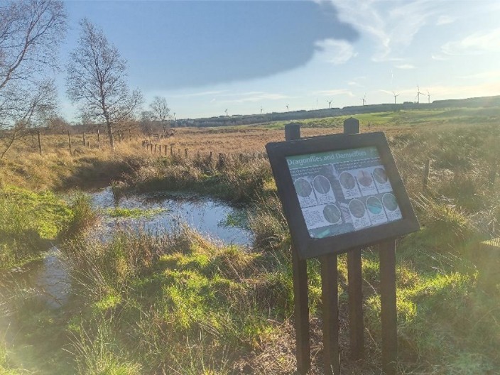
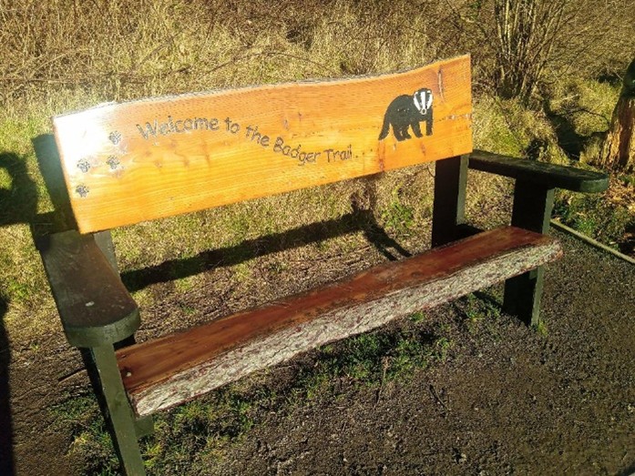
Recce: This is a 7-mile circular walk starting from Cumbernauld train station via Forest Wood Wildlife Reserve & Palacerigg Country Park (Palacerigg Country Park).
The walk has stunning views northwards to the Campsies and beyond to the Southern Highlands. The paths meander through areas of birch and alder woodland. In addition to woodland paths, we cross a boardwalk alongside a badger trail and over raised bog land and gravel paths adjacent to an encapsulated golf course.
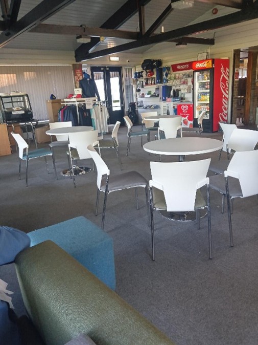
Flora and fauna include roe deer, badgers, kingfishers, water voles, owls, frogs, dragonflies & damselflies and bluebells on a good day. We will stop for a beverage at the Palacerigg Golf Club (Palacerigg Golf Club) where hot and cold snacks can be purchased at a very reasonable price.
Thereafter, we will make our way through the woodland via a shorter return route back towards Cumbernauld train station. Poles and walking shoes / boots (if wet) recommended.
Pre-walk comfort stop: Monklands District Hospital
Post-walk social stop: Palacerigg Golf Club (1 hour)
Walk. 3
08 April
Braveheart Circular:
Time & Travel: We will catch the 9.36 a.m. train from Coatdyke to Queen Street (arriving 10.00 a.m.). Transfer to Platform 5 to catch the Stirling train (10.07 a.m.) arriving 10.34 a.m. The walk will start at 10.45 a.m. There are regular trains running from Stirling to Glasgow for the return journey.
Finish time: x hours (approx.)
Recce: This is a 7.5-mile circular walk starting from Stirling Train station walking primarily on pavement. There are a couple of steep uphill sections which we take at a suitable pace for everyone.
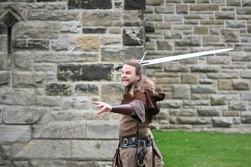
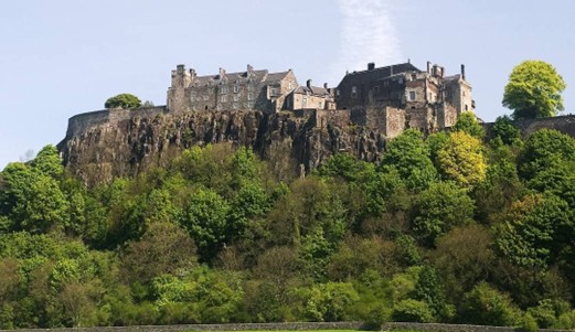
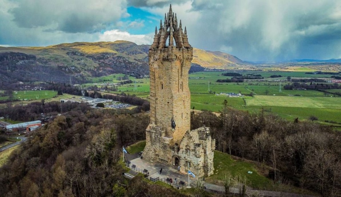
From the station we will make our way via a 13th Century Abbey (Cambuskenneth Abbey | Historic Environment Scotland | History) to the Wallace Monument which has stunning panoramic views over the city of Stirling, Stirling bridge and Stirling Castle.
At the Monument we are treated to a free (15 min) presentation by a re-enactor who will present the history associated with Robert the Bruce, William Wallace and other famous historical figures of the period (Events – National Wallace Monument).
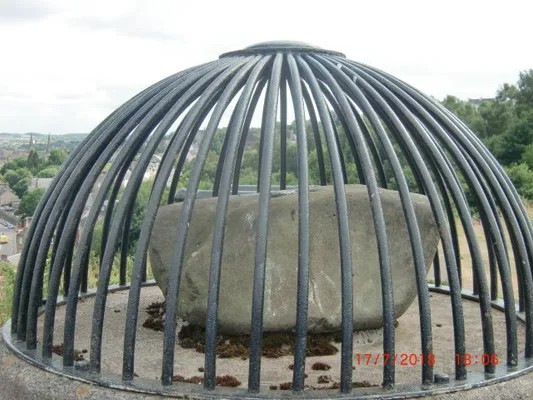
Thereafter, we will make our way to the Beheading Stone via the Black Walk – passing the site where the Battle of Stirling Bridge too place. We will stop for lunch at the Beheading Stone (Beheading Stone – Atlas Obscura).
We end the walk by walking through the Old Town Cemetery (with a stunning viewpoint of Stirling Castle), Cowane’s Hospital and Stirling Old Town Jail.
Poles and walking shoes / boots (if wet) recommended. Trainers on a dry day.
Comfort stops: Legends at the Monument Café (Legends at the Monument) & Cowane’s Hospital (Cowane’s Hospital :: Stirling City Heritage Trust).
Pre-walk comfort stops: Queen St station, train & Stirling train station
Post-walk social stop: The Crossed Peels (The Crossed Peels – J D Wetherspoon)
Walk. 4
20 May
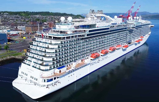
Cruising with June MacDonald:
Time & Travel: We will catch the 9.17 a.m. train from Coatdyke train station arriving at Queen St. station at 9.41 a.m., walk to Platform 5 to catch the ‘Anniesland’ train at 10.04 a.m. to Possilpark & Parkhouse train station arriving 10.24 a.m. We walk to Lambhill Stables (15 min) for a comfort stop (30 min). We will begin the walk at 11.15 a.m. to arrive at The Stables boarding point at 1 p.m.
Please purchase a single ticket to Possilpark & Parkhouse train station.
Return journey from Kirkintilloch is by bus via the X85 ‘Glasgow’ bus from Freeland Place i.e. bus stop next to ‘The Kirky Puffer’.
Finish time: x hours (approx.)
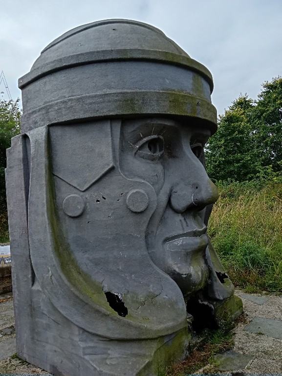
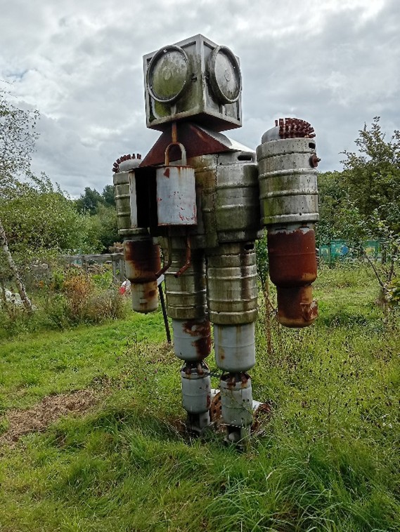
Recce: This is a 6.5-mile linear walk from Lambhill Stables Community Café. After bidding voyage to the Roman Centurion & Rocket Man we embark on the Forth & Clyde canal towpath to Kirkintilloch.
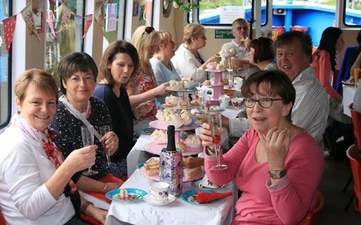
We break up the route mid-way to board the Voyager canal boat (a 45-seater canal boat Boats | Voyager | Forth & Clyde Canal Society) to enjoy a 2 hour cruise along the Clyde.
The Voyager is operated by the Forth & Clyde Canal Society (Forth & Clyde Canal Society – Boat Trips – Cruises & Hire). Food and drink (incl. alcohol) are allowed on board.
After disembarking, we return to Kirkintilloch along the canal towpath for a celebratory drink at the Kirky Puffer (The Kirky Puffer – J D Wetherspoon).
Footwear: Walking shoes / boots (if wet/muddy) and poles recommended.
Pre-walk & Walk comfort stops: Lambhill Stables Community Cafe (Community Hub Glasgow | Lambhill Stables | Café | Bike Hub)
Post-walk social stop:
The Kirky Puffer, Kirkintilloch (The Kirky Puffer – J D Wetherspoon).
Information from the Skipper: “The Stables was built to serve the watermen and horses using the Forth and Clyde Canal. When the canal was first built the boats that used it were pulled by horses. As a horse could go a few miles before needing a rest, stables were built along the canal at 4-mile intervals.
Sailing towards the historic town of Kirkintilloch look out for herons and other aquatic and birdlife. Sit back, relax, people-watch and don’t forget to wave to those walking along the towpath and passengers on-opposing boats.
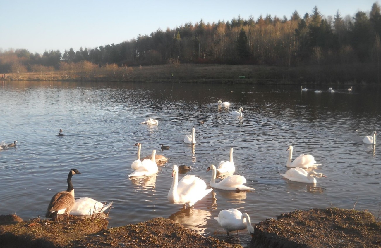
There are several swans and duck families on this stretch of the canal. The Millenium Bridge is situated just outside the Southbank Marina and is shaped like the bow of a boat. St Mary’s Church is a striking pink Sandstone neo-Gothic church.
It was built in 1914 to replace the old church, which is now the town’s museum. A feature of the church is its tall square tower topped with pinnacles. Next on our cruise is the Luggie Aqueduct passing the site of the old Lion Foundry.
Great views of the Campsies can be seen from the aqueduct. Enjoy the cruise!”
Walk. 5
24 June
Three Lochs Linear – Salsburgh to Caldercruix:
Time & Travel: We will catch the #202 ‘Salsburgh’ bus from Quarry Street, Coatdyke (bus stop opposite Corner Shop & outside Lomond Court) @ 9.49 a.m. arriving 10.23 a.m. We start the walk shortly thereafter.
N.B. Ramblers can board the bus en route between Coatdyke & Salsburgh at various bus stops.
Return journey: Train service every 30 min. Bus service every hour.
N.B. Bus / Train times likely to change so please check webpage for updates. Poles and walking shoes / boots recommended.
Finish time: 2.00 p.m (approx.).
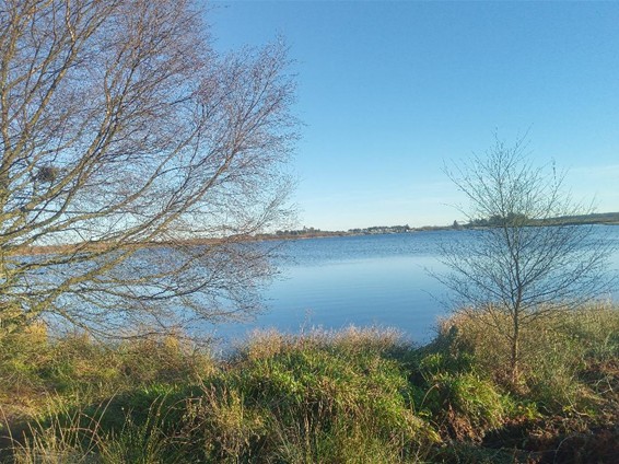
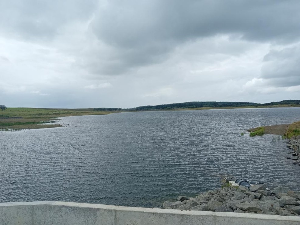
Recce: This is a 5-mile linear walk from the village of Salsburgh (Salsburgh (Wikipedia)) to the village of Caldercruix (Caldercruix (Wikipedia)) and includes walking on tarmac, country road, farm track and field’s passing three lochs en route.
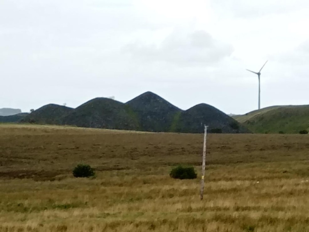
Initially we follow an abandoned railway track towards Roughrigg Reservoir, then onwards to Duntilland Rd with a stunning view to our right-hand side of the Salsburgh four brothers (bings) before we reach the high point of the walk (300ft) at the foot of the impressive Black Hill B Transmitter station (Black Hill transmitting station (Wikipedia)) where we will stop to watch the lunchtime news.
We continue to gradually walk downhill and via a farm road at Bracco Farm we cross over a couple of stiles into a field with sheep before continuing along a disused and overgrown farm road emerging at the Lily Loch. As we walk towards Caldercruix stunning views of Hillend Loch can be seen.
This walk will be led by David Dunn.
Footwear: Walking shoes / boots & poles recommended
Comfort Stop: Not applicable on the walk. Available on the train to Airdrie.
Post-walk Social Stop: The Stirling, Airdrie (The Stirling (Amber Taverns))
Walk. 6
22 July
Drumpellier Country Park Woodland Circuit:
Time & Travel: We catch the #245 ‘Moodiesburn’ bus from Asda Coatbridge westbound bus top at 10.15 a.m. arriving at Drumpellier Country Park at 10.23 a.m. We will start the walk at 10.45 a.m.
To return to Coatbridge Asda we catch either the #245 ‘Coatbridge’ bus from the stop opposite the car park at Bizzi Izzi’s (hourly: 4 min past the hour) or the #7 ‘Coatbridge’ bus from Tay Street – a 5 min walk at 13 min, 33 min & 53 min past the hour.
Finish time: x hours (approx.)
Recce: This is a 5-mile circular walk starting from the picnic tables adjacent to the entrance to Drumpellier Country Park visitor centre (Drumpellier Country Park | North Lanarkshire Council).
The park covers an area of 500 acres and includes two natural lochs with various wildlife on display. We walk briefly along the western side to Lochend Loch to enter Home Farm Woods.
Thereafter, we walk along several interlinking woodland, moorland and grassland paths – returning via the Monklands Canal on the southern perimeter. Passing underneath Blairhill railway underpass, we start our return journey by wandering through Garnheath Woods to finally emerge at the Peace Garden by the side of Lochend Loch.
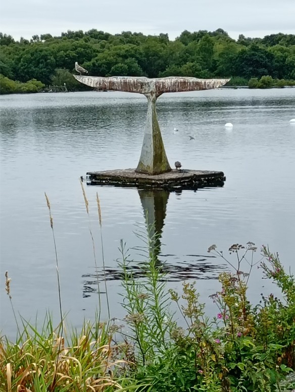
After a brief stop there for a period of reflection & a wee blether, we make our way along the tarmac footpath around the loch to the Visitor Centre passing the Crannog & Whale Tail.
Footwear: Walking shoes and poles recommended.
Pre-walk comfort stop: Drumpellier Country Park visitor centre (opposite car park).
Post-walk social stop: Post-walk social stop: Bizzi Izzi’s, Lochhead Golf Club, Townhead (BIZZI IZZI’S AT THE VIEW, Coatbridge – 2026 Reviews & Information). For those travelling by car there is a car park at the Golf Club.
Walk. 7
26 August
St Maurice’s Pond and Broadwood Loch Circular:
N.B. Bus / Train times likely to change so please check webpage for updates.
N.B. Other modes of transport and connections are available to and from the start/end of the walk.
Time & Travel: We catch the #347 bus from Monklands District Hospital at 10 a.m. to Cumbernauld Town Centre (CTC) bus station arriving at 10.40 a.m. We will switch onto the #435 ‘Kilsyth’ bus at 10.45 to North Road, Condorrat (bus stop opposite the SPAR shop) arriving at 10.51 a.m. We will walk the short distance to the car park at St. Maurice’s Pond (5 min) where the walk will commence at 11.00 a.m.
The #435 bus back to CTC from Condorrat run every 30 min e.g. 2.08 p.m., 2.38 p.m. & 3.08 p.m. to meet up with the #347 to Monklands GH.
Finish time: 2.5 – 3 hours (approx.)
Recce: This is a 5-mile circular walk from St Maurice’s Pond, Condorrat on solid level paths throughout – to and around Broadwood Loch & through Orchardton Woods.
After a short trail along a gravel path around St. Maurice’s Pond (Why St Maurice’s pond is a special place! – Cumbernauld Living Landscape), the walk entails a small section of pavement walking before reaching Broadwood Loch & Orchardton Woods (Photographs and map of Broadwood Loch and Orchardton Woods at Cumbernauld in North Lanarkshire in central Scotland) and returns via Broadwood Football Stadium.
At St. Maurice’s pond, there is a small car park available. Within Orchardton Woods, we follow the Frog, Kingfisher and Woodpeckers’ trails respectively – eventually reaching a very scenic picnic area for a snack overlooking Broadwood Loch. We can have a snack / lunch / cuppa at the end of the walk in Boolers Café, a community café located within Condorrat Social Club which is open to the public.
The area surrounding St. Maurice’s pond and Broadwood loch has been designated a Site of Importance for Nature Conservation (SINC) which is reflected in the rich diversity of flora and fauna.
Footwear: Trainers / Walking shoes. Poles optional
Pre-walk comfort stop: Monklands District Hospital
Post-walk social stop: Boolers Café (Boolers Cafe, Condorrat Social Club, 9 Main Road, Cumbernauld., Cumbernauld (2026)), Condorrat Social Club.
Walk. 8
16 September
Its Graduation Day at Cloisters:
Time & Travel: We catch the 10.05 a.m. train from Coatdyke train station to Queen Street station arriving 10.30 a.m. We transfer to Buchanan St subway station to catch the 10.48 a.m. train to Kelvinhall subway station arriving 10.57 a.m. Book a return journey subway ticket. Concessions apply.
We’ll gather outside the Kelvinhall Subway Station on Dumbarton Road, a short walk from Kelvingrove Park. The walk will commence at 11.15 a.m.
Return journey: From Kelvingrove Subway return to Buchanan St. subway station and walk to Queen St. station.
N.B. Alternate travel routes are available to/from the start/end of the walk.
Finish time: x hours (approx.)
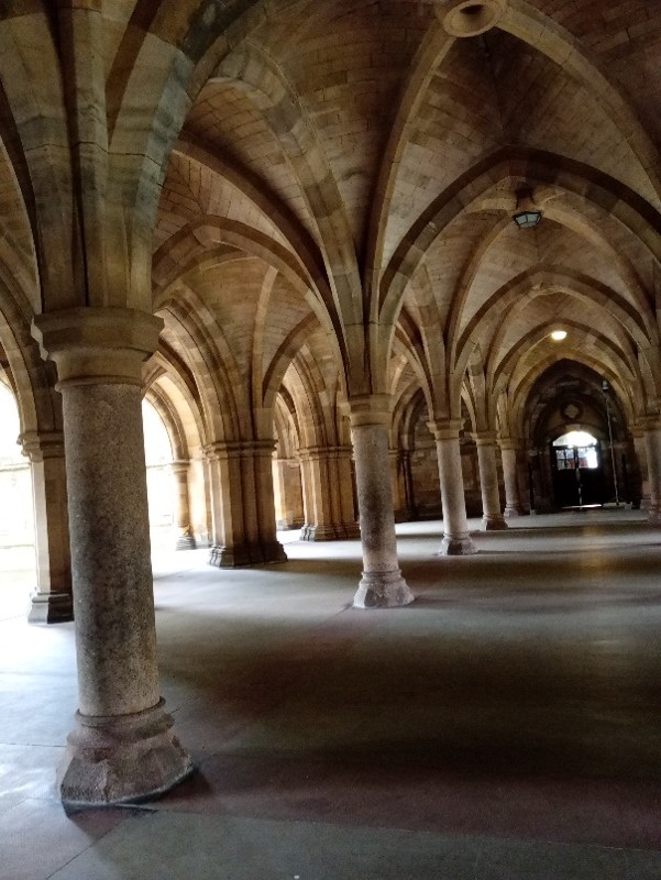
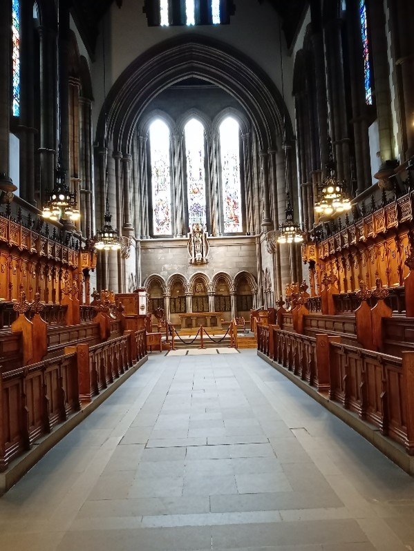
Recce: This is a 5.5-mile linear walk from Kelvinhall subway station to Kelvingrove subway station via Gilmorehill Campus, University of Glasgow to enable Wednesday Walk graduands to graduate at Cloisters Undercroft.
No need to bring your graduation gown or academic cap – both will be provided on the day! If you have an old gown/cap, bring it along for a colourful group photo! We will start the walk from Kelvinhall subway station on Dumbarton Road before entering Kelvingrove Park via Sunlight Walk.
After crossing Snow Bridge, we make our way to Kelvingrove Museum & Bandstand via the Cameronians War, Battle of Normandy, Stewart, Kelvin & Lister Memorial statues – reflecting on the importance of these celebrated memorials. We re-join Sunlight Walk and enter the iconic tower of the Gilbert Scott Building from where we’ll enjoy views of the city. We’ll take in the East and West Quadrangles of the campus, the Cloisters and Professors’ Square before heading to ‘One A – The Square’ (Brasserie Café) for a cuppa.
Thereafter, we exit the University via the famous Memorial Gates onto University Avenue and walk along Kelvin Way passing Suffrage Oak & the Thomas Carlyle statue before crossing the Prince of Wales bridge. After the Highland Light Infantry & South African War memorials, we back track a little to walk along the Kelvin walkway to Kelvingrove Subway.
Shoes: This is an urban walk, all on tarmac. Comfy shoes recommended.
Pre-walk comfort stops: Toilets available at Queen St. station.
Post-walk social stop:Counting House adjacent to George Sq. (The Counting House – J D Wetherspoon).
Walk. 9
07 October
David Livingstone Centre, Clyde Walkway and Redlees Park Circuit:
Time & Travel: We catch the ‘Motherwell’ train from Whifflet train station (Platform 2) at 10.03 a.m. – arriving 10.10 a.m. and catch the ‘Dalmuir’ train (Platform 4) to Blantyre at 10.17 a.m. – arriving 10.31 a.m. Walk down to the DL centre and after a comfort stop start the walk at 11.15 a.m.
Return journey: Various train returns are available from Blantyre (both direct & indirect) to Whifflet train station – depending upon departure time.
Finish time: 2 hours (approx.)
Recce: This is a 6-mile circular walk from the David Livingstone Centre, Blantyre and entails a variety of riverside and forest paths which can be muddy. We will begin the walk from the David Livingstone Visitor Centre café (Cafe – David Livingstone Birthplace) after a pre-walk comfort stop.
After we cross the David Livingstone Memorial Bridge, we take a meandering forest path along the Clyde Walkway to the medieval Bothwell Castle on the bank of the River Clyde. We eventually reach the Green Bridge which directs us to the newly reformed Redlees Urban Park and WW2 airgun battery where we will stop for lunch.
There is a great deal of wildlife in the area covered, including roe deer, badger, squirrel, heron, waxwings, greylag geese – and otter on a good day.
Footwear: Poles and walking shoes / boots (if wet) recommended.
Post-walk social/lunch stop: Village Bar, Blantyre (Village Bar (Google Maps)) – 3 min walk from Blantyre train station.
Walk. 10
16 December
Bowling to Knightswood Linear:
Time & Travel: We catch the 9.46 ‘Balloch’ train from Coatdyke train station to Bowling train station arriving 10.45 a.m.
Knightswood to Great Western Road: We catch the #16 ‘Govan’ bus to Crow Road, near Great Western Road either at 13 min & 48 min past the hour.
Return journey: #6/6A ‘Glasgow’ bus to City Centre from Ascot Avenue, Great Western Road. Regular bus and train are available to Coatbridge.
Finish time: x hours (max).
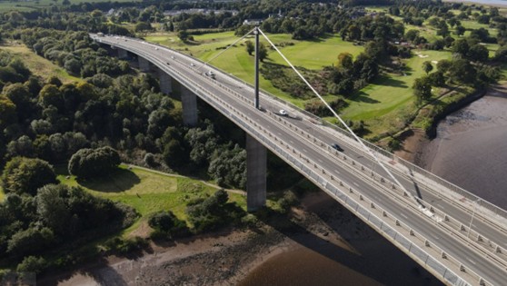
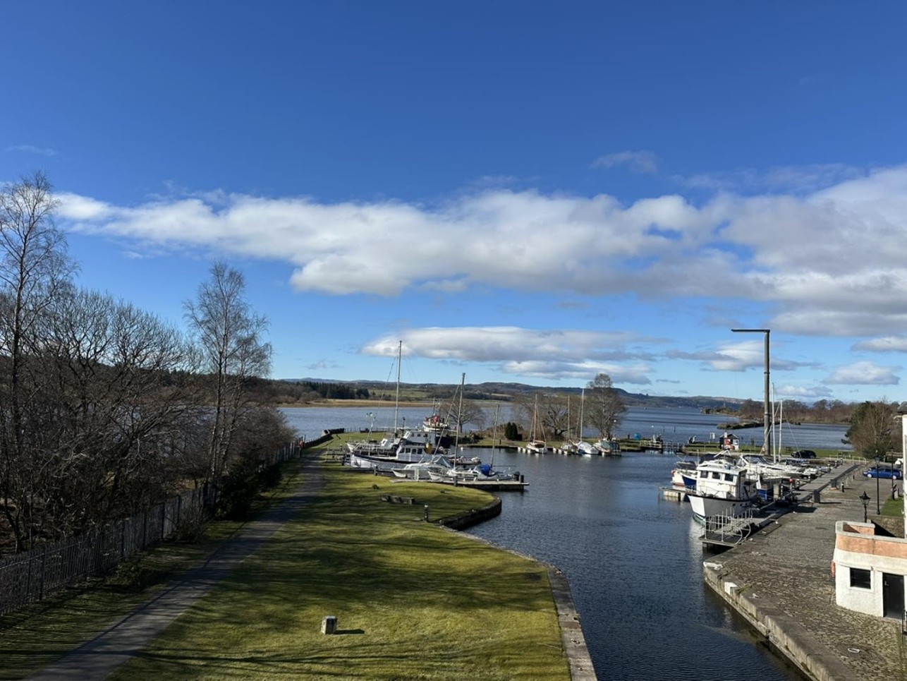
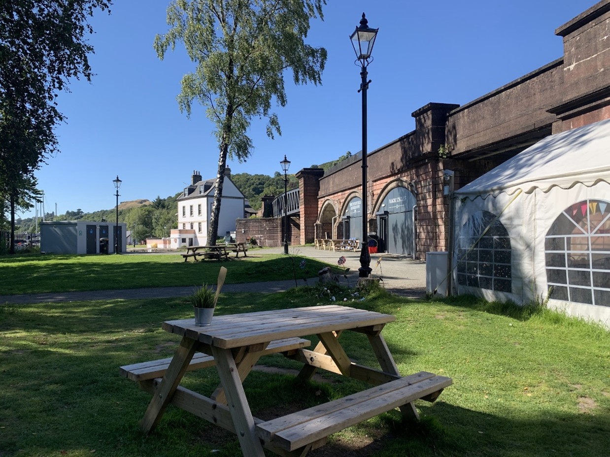
Recce: This is an 7-mile linear walk along the Forth & Clyde canal towpath starting from Bowling train station to Knightswood, Glasgow (Forth & Clyde Canal: Bowling to Maryhill (Walkhighlands)). Upon arrival, we will walk the short distance to the start of the walk at Paton’s Place Café, Bowling Harbour.
The canal is a haven for wildlife: swans, herons, moorhens and ducks whilst kingfishers and otters have been spotted. As we walk along the towpath, we will pass underneath the impressive Erskine Bridge and numerous canal locks & canal boats. Overhead, numerous aircraft from various airlines can be spotted making their descent into Glasgow Airport.
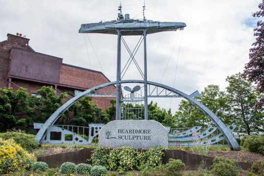
Along the route, we pass an impressive sculpture marking the entrance a historical shipyard which built Dreadnaughts and other military ships during WWI. From an engineering perspective, we will also cross a road which resulted in a unique canal ‘drop lock’ being constructed – the only one of its kind in Europe.
Further along the towpath, we reach the Clyde Shopping Centre where we will have a comfort stop & lunch. We continue along the towpath for a few miles before exiting the route at Rotherwood Avenue, Knightsbridge and boarding a local bus on Banner Road to Great Western Road.
Footwear: Trainers will suffice.
Pre-walk comfort stop: Paton’s Place Café (Paton’s Place).
Comfort stops: Clyde Shopping Centre
Post-walk social stop: The Esquire House, Great Western Road Glasgow (The Esquire House (J D Wetherspoon)).


sign up to our newsletter, as we usually send updates on a wednesday evening.
(Remember to check your spam or junk folder too.)
Quick Links
home
about
Starter for £10
Clothing guide
sponsors
find a walk
pick-up
Committee
contact
RA Membership
Monklands Ramblers is an official Ramblers Association Group. We receive annual funding from the RA to finance club administration such as the website, walk leader recce expenses, the Fiver promotion etc.
RA members receive a welcome pack plus excellent quarterly magazine and an entitlement to walk with any Ramblers group in Britain. There is also access to an extensive online library of walks and discounts available to members eg Cotswold Outdoor Company, O.S maps, Ramblers Holidays etc.
You can join the RA here.
Please indicate your local group is: Monklands.
Information


The Ramblers' Association is a company limited by guarantee, registered in England and Wales. Company registration no. 4458492. Registered charity, Scotland no. SC039799.
Monklands Ramblers © 1985-2026
